Hatcher Pass is a mountainous pass that rises 3,886 ft or 1,148 m. It is accessed from Palmer and Wasilla to the south or by the Parks Highway to the west near Willow. That is where our adventure begins. Let me warn you this unbelievably scenic drive is not for the weak at heart. Let me show and tell you why.
To start Willows elevation is approximately 250 ft or 76 m. The day wasn’t the greatest but if you wait for a sunny day your holiday will be over before you get started. As we turn on to Fishhook Road a sign starring us in the face indicates the pass is open…just opened on July 4.
For the first 6 miles or so the road is paved, no potholes, nice and smooth. Hey this is not so bad. We drive beside Willow Creek for some time. There is evidence that the area is still actively mined on a small scale. Some build bridges to get across the river others seek other means.
The road has now changed to hard packed gravel and dirt. There are a few potholes but not many. And of course it starts raining, just a little off and on. Not bad so far. The scenery is breathtaking. We still haven't really started to climb, we are more in the valley.
So now we start to climb towards Hatcher Pass. The road gets more dirt than gravel and the scenery becomes more mountainous. It is not recommended to bring any RV or large vehicle on this road because of it's steep grades, rough roads, and tight hair-pin corners.
This is the point where things started getting very surreal. You can't really tell but on my right it is a shear drop of 1,000 ft and on my left is a wall of rock where an avalanche can happen at any time. Because the road just opened they are grading it for the first time. How are we going to get around this guy. He is going 2 mph. On this wet dirt I have fishtailed many time. Kathy and Bob are following in their truck and have been watching the back end slip and slide. Now the roads are getting a little hairy.
We finally get past the grader as he pulled over to let us by. I'm thinking that maybe I should have stayed behind him, maybe he can make the road smoother for us. I'm also thinking I'm sure glad Susan is not in the truck. She would be ripping my face off right now and screaming some unpleasantries.
Even though the road was rough and washboardy(if that's a word) I had to stop and make time to play in the snow. Remember, I'm a true Canadian girl at heart and I love the cold.
We finally reached Hatcher Pass. Now I know why the road didn't open until July 4.
Summit Lake State Recreation Site is located close by to Hatcher Pass. Summit Lake is a tarn reaching a depth of 20 feet. A tarn is a mountainous lake or pool formed from glacier activity. If you think they look cold, they were cold. And you guys call yourself Canadians.
We now start the long descent down toward Independence Mine. Most of the time I would rather go uphill then downhill. I was sliding all over the place. Was I scared, not really.
They say the main attraction of Hatcher Pass is Independence Mine. I think just the opposite, it's the shear beauty of the mountains, water, and the absence of crowds and noise. As we got closer to the mine there were more and more people, cars, and noise.
Independence Mine is a 272 acre state historical park. During the day they discovered hard rock (lode) gold scattered in veins throughout these mountains. Erosion caused gold bearing gravel and sand to be washed downstream where the flakes settled in the river beds. Placer mining with pans and sluice boxes preceded lode mining. In 1941 Alaska-Pacific Mining Company employed over 204 men, blasted nearly a dozen miles of tunnels, and produced 34,416 ounces of gold worth 1,2 million dollars. The claim covered 1,350 acres and included 27 structures. Several of these structures have fallen into disrepair.
 |
| Skyscraper Mountain the site of Hatcher's discovery |
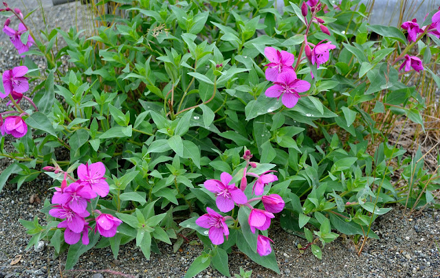
We always have to make time to stop and smell the flowers. Here in Alaska they have some beautiful summer roadside flowers.


No comments:
Post a Comment