After two wonderful days in Carcross we are moving on. The decision not to go to Skagway was mutual, I have been there before and Susan said next time. And you know there will be a next time. So away we go on a beautiful morning.
Our one and only stop we made was for diesel at Teslin, a place we stayed on the way up to Alaska. It doesn't seem as busy. After fueling up we pulled to the side of the parking lot and had lunch with my friends (the ones with antlers). The Nusutlin Bay Bridge is in the background. The dogs were having a great time.
Continuing on down the road, we really didn't see much wildlife. By this time usually everything is in the bush out of the direct sun and heat. We did pass this unusual rock formation. If it had less trees and greenery I would have thought we were in Arizona.
We stopped for the night at Baby Nugget Campground which it right at the junction of the Alaska Highway and the Stewart-Cassier Highway. So that means it's about 25 km from Watson Lake. There's lots of wildfires around Watson Lake, not to bad here. We could smell the smoke but visibility was good.
After we set up camp I took the dogs for a much needed long walk around the entire park. We were gone for a good half hour. The park in the meantime started filling up with Caravan people. This caravan we had been seeing off and on throughout our travels.
After I got back Susan wanted to go for supper at the Wolf It Down Restaurant right in the campground. We both ordered the burger and fries with a side of gravy. It was the worst food and the most expensive on our entire trip so far. This park was highly rated in our books and on line that's why we stopped here. I would give it a two out of ten. The owners attitude as far as I'm concerned stunk. She complained that people were coming in early (1 o'clock) to camp for the night. I would think she would be happy about that. She also complained they had 70 units in the night before. Not something I would complain about. Maybe she's in the wrong business. If it hadn't been for the nice surroundings we would have left. But I did enjoy the grass and trees. Better than a dusty gravel parking lot any day.
We are on the Stewart-Cassier Highway tomorrow, hope to see some bears or moose. Who knows with nature, they show up at the most unusual times.
Showing posts with label Yukon. Show all posts
Saturday, August 4, 2018
Day 69 - Nugget City, YT
Thursday, August 2, 2018
Day 67 - Carcross, YT
It was a late morning for all of us knowing that the driving distance was short, 48 miles to Carcross. We discussed staying another day in Whitehorse but decided against it. So down the road we go arriving at our next destination. Like always we got set up then started exploring.
Our first stop was Emerald Lake. It was absolute beautiful with the sun shining on it. The limestone hills in this area were created 150 – 200 million years ago by reef-building corals that grew in a warm sea. Corals and lime-secreting algae cemented themselves together in 100 meters of water where there was sunshine and clear water. As the water rose the coral reef built upon itself, growing toward the light. The valley was covered by a glacier during the last ice age and shallow lakes were formed when the glaciers retreated 14,000 years ago. Retreating ice deposited limestone gravel which was eroded from the surrounding hills, onto the valley floor. The carbonate rich gravel affected the ground water and led eventually to the formation of marl in the lake. The beautiful blue-green colour of Emerald Lake is created by sunlight reflecting off a white layer of “marl” on the lake bed. Marl is a white calcium carbonate clay that forms in the water and then settles, often unevenly, on the lake bottom. The Marl forms when enough carbonate, from dissolving limestone, reacts with calcium in the water.
It looks like a desert but is it a desert…
If this were a real desert, it would have a hot, dry climate. The Carcross Dunes are a result of a glacial process. About 10,000 years ago, the great ice sheets that covered much of North America were melting. Ice dams created a series of glacial lakes that submerged some valleys under 300 meters of melt water. A layer of sand and silt, which had been trapped in the glaciers, settled to the bottom of these lakes in a thick layer. Glacial Watson Lake is long gone but rivers cut through the old lake bottom sediments bringing sand and silt into Bennett Lake. Today, the sand comes mainly from nearby Bennett Lake carried by wind.
The Cariboo Crossing Trading Post is located about 2 km north of Carcross. It’s basically a one stop shop which has everything you need for an afternoon of fun…or so we thought. The admission cost is $8.75 and that gets you into the Wildlife Museum (taxidermy animals), the Mountie Museum, the animal petting zoo, and the husky puppies. Now that is what I really wanted to see. Everything else, such as gold panning, dog cart rides, and lunch of course are all extras. I guess I was expecting something a little more exciting. It’s a been there, done it, won’t be doing it again place. If you know what I mean.
After a late lunch early supper I took a stroll across the street to the Carcross First Nations Community Center. It's brand new and beautiful.
Our first stop was Emerald Lake. It was absolute beautiful with the sun shining on it. The limestone hills in this area were created 150 – 200 million years ago by reef-building corals that grew in a warm sea. Corals and lime-secreting algae cemented themselves together in 100 meters of water where there was sunshine and clear water. As the water rose the coral reef built upon itself, growing toward the light. The valley was covered by a glacier during the last ice age and shallow lakes were formed when the glaciers retreated 14,000 years ago. Retreating ice deposited limestone gravel which was eroded from the surrounding hills, onto the valley floor. The carbonate rich gravel affected the ground water and led eventually to the formation of marl in the lake. The beautiful blue-green colour of Emerald Lake is created by sunlight reflecting off a white layer of “marl” on the lake bed. Marl is a white calcium carbonate clay that forms in the water and then settles, often unevenly, on the lake bottom. The Marl forms when enough carbonate, from dissolving limestone, reacts with calcium in the water.
It looks like a desert but is it a desert…
If this were a real desert, it would have a hot, dry climate. The Carcross Dunes are a result of a glacial process. About 10,000 years ago, the great ice sheets that covered much of North America were melting. Ice dams created a series of glacial lakes that submerged some valleys under 300 meters of melt water. A layer of sand and silt, which had been trapped in the glaciers, settled to the bottom of these lakes in a thick layer. Glacial Watson Lake is long gone but rivers cut through the old lake bottom sediments bringing sand and silt into Bennett Lake. Today, the sand comes mainly from nearby Bennett Lake carried by wind.
The Cariboo Crossing Trading Post is located about 2 km north of Carcross. It’s basically a one stop shop which has everything you need for an afternoon of fun…or so we thought. The admission cost is $8.75 and that gets you into the Wildlife Museum (taxidermy animals), the Mountie Museum, the animal petting zoo, and the husky puppies. Now that is what I really wanted to see. Everything else, such as gold panning, dog cart rides, and lunch of course are all extras. I guess I was expecting something a little more exciting. It’s a been there, done it, won’t be doing it again place. If you know what I mean.
After a late lunch early supper I took a stroll across the street to the Carcross First Nations Community Center. It's brand new and beautiful.
| Local Artist Suzanne Paleczny |
Wednesday, August 1, 2018
Day 66 - Whitehorse, YT
We left Haines Junction enroute to Whitehorse which is about 150 km. It was a pretty easy drive, no major hills and the roads were not bad at all.
We made one stop along the way and that was at the old Canyon Creek Bridge. In 1903, a gold strike brought a stampede of miners to the area. A wagon road was built from Whitehorse and a bridge was constructed over Canyon Creek. During construction of the Alaska Highway in 1942, the old bridge was dismantled and a new one built in 18 days. This little bridge was left in place when a more permanent bridge was built downstream.
We got to Pioneer RV Park which is the same park we stayed in last time we were in Whitehorse. Again we set everything up then went into town for some much needed groceries. We lost most of our meat and refrigerator stuff a few days after the cooling unit went. Anyway it is all good.
After shopping we went back to the campground got caught up on laundry and spent some quality time with the dogs.
We made one stop along the way and that was at the old Canyon Creek Bridge. In 1903, a gold strike brought a stampede of miners to the area. A wagon road was built from Whitehorse and a bridge was constructed over Canyon Creek. During construction of the Alaska Highway in 1942, the old bridge was dismantled and a new one built in 18 days. This little bridge was left in place when a more permanent bridge was built downstream.
| Old Canyon Creek Bridge |
| Canyon Creek |
| Canyon Creek and New Bridge |
After shopping we went back to the campground got caught up on laundry and spent some quality time with the dogs.
Tuesday, July 31, 2018
Day 64 & 65 - Haines Junction, YT
After a fun night in Tok it was time to be on the road again. Our next destination is Haines Junction, Yukon. Yes, we will be back in Canada soon.
Just after we dieseled up we started noticing the smell of smoke in the air. I found out later it was a wildfire near Tok. The Taixtsalda Hill Fire southeast of Tok has grown significantly since it started. The fire is now estimated at 18,406 acres. The fire, which started July 23rd, is burning in a remote area approximately 14 miles southwest of the village of Northway and 38 miles southeast of Tok. It is approximately 20 miles west of the Alaska Highway. It is being investigated but human error is likely the cause. At one point the smoke got pretty thick. Anyone with a breathing issue would be in trouble.
We made a quick stop at the international border rest area for a photo op. The 141st meridian longitude marks the boundary between the Yukon and Alaska. This boundary extends from the Arctic Coast to Mount St Elais, a distance of 2,475 km. The border between Canada and the United States is the longest undefended boundary in the world.
The line that forms the border between the Yukon and Alaska was first described in an 1825 treaty between England and Russia. The two nations divided the northwest giving Britain the rights for inland fur and Russia rights to the Bering Sea. In 1867 the U.S. purchased Alaska (I mentioned this in another blog). When gold was discovered in the Klondike in 1896, a dispute erupted regarding the southeast boundary, with both Canada and the U.S. claiming the seaport at the head of Lynn Canal. In 1903 the arbitrators ruled that the canal was part of Alaska and not Canada.
Behind the middle spruce tree is a 20 foot or 6 meter swath of land that was cut by surveyors in 1904 to 1920 which marks the Alaska-Canada border. Portions of the swath is cleared periodically by the International Boundary Commission.
We reached Canada Customs and the young customs officers looks like he just came from a gold rush town. He was really nice, asked alot of questions I'd never been asked before. He also wanted to see the dogs vaccination papers. Again, something we had never been asked. Most of the time they don't know we have dogs in the back seat.
We made a quick stop or we thought it was going to be quick at Pickhandle Lake Rest Area. It was so beautiful and peaceful we stayed longer, just to admire the view and watch the ducks come and go. This lake is one of western North America’s most important bird migration corridors leading from South America, the Gulf of Mexico, the US Midwest, the west coast of the US and Canada into central Yukon and Alaska. This lake is a primary nesting area for trumpeter swan. Today we saw none.
Between 300 and 400 years ago, Kaskawulsh Glacier advanced across the Slims River closing the drainage outlet of Klaune Lake. The water levels rose more than 10 meters or 30 feet reversing the lake's drainage pattern. Today, that drainage pattern has been permanently altered resulting in a beautiful blue lake.
Haines Junction is best known as the access point to Kluane National Park and Reserve, a beautiful wilderness park, with glaciers, mountains, and wildlife. Kluane National Park and Reserve, together with Tatshenshini-Alsek Provincial Park in British Columbia, Wrangell-St. Elias National Park and Glacier Bay National Parks in Alaska, form the largest internationally protected area on earth. In 1980, Kluane National Park and Reserve was designated a UNESCO World Heritage Site. The park encompasses a portion of the St. Elias Mountains, including Mount Logan, Canada's highest peak.
The village itself was established in 1942, during construction of the Alaska Highway. The area population of Haines Junction in approximately 850 people.
The new Champagne and Aishihik First Nations' Da Ku Cultural Center is also the home of Parks Canada and Yukon Territorial Visitor Center. We had to explore. An elder died so the Da Ku Center part was closed. We watched a 25 minute film on the Kluane National Park. It was one of the best we have seen so far.
Our Lady of the Way Catholic Mission is quite a local attraction. It was built in 1954 by the first Catholic priest to preach in the area. Because resources were scarce the priest converted an old Quonset hut (lightweight prefabricated structure of corrugated galvanized steel) used by the American Army during construction of the Alaska Highway.
Another unique and quaint church is the St. Christopher's Anglican Church which sits in the heart of Haines Junction. This church was constructed in early 1990 by local volunteers and is used for Sunday services even today.
The most photographed spot in all Haines Junction is the Village Monument. The 24 foot high sculpture which locals have nicknamed "The Muffin" or "Animal Cupcake" is located at the junction of the Haines and Alaska highways. The sculpture depicts almost life size area wildlife on a snow capped mountain.
Just after we dieseled up we started noticing the smell of smoke in the air. I found out later it was a wildfire near Tok. The Taixtsalda Hill Fire southeast of Tok has grown significantly since it started. The fire is now estimated at 18,406 acres. The fire, which started July 23rd, is burning in a remote area approximately 14 miles southwest of the village of Northway and 38 miles southeast of Tok. It is approximately 20 miles west of the Alaska Highway. It is being investigated but human error is likely the cause. At one point the smoke got pretty thick. Anyone with a breathing issue would be in trouble.
We made a quick stop at the international border rest area for a photo op. The 141st meridian longitude marks the boundary between the Yukon and Alaska. This boundary extends from the Arctic Coast to Mount St Elais, a distance of 2,475 km. The border between Canada and the United States is the longest undefended boundary in the world.
The line that forms the border between the Yukon and Alaska was first described in an 1825 treaty between England and Russia. The two nations divided the northwest giving Britain the rights for inland fur and Russia rights to the Bering Sea. In 1867 the U.S. purchased Alaska (I mentioned this in another blog). When gold was discovered in the Klondike in 1896, a dispute erupted regarding the southeast boundary, with both Canada and the U.S. claiming the seaport at the head of Lynn Canal. In 1903 the arbitrators ruled that the canal was part of Alaska and not Canada.
Behind the middle spruce tree is a 20 foot or 6 meter swath of land that was cut by surveyors in 1904 to 1920 which marks the Alaska-Canada border. Portions of the swath is cleared periodically by the International Boundary Commission.
We reached Canada Customs and the young customs officers looks like he just came from a gold rush town. He was really nice, asked alot of questions I'd never been asked before. He also wanted to see the dogs vaccination papers. Again, something we had never been asked. Most of the time they don't know we have dogs in the back seat.
We made a quick stop or we thought it was going to be quick at Pickhandle Lake Rest Area. It was so beautiful and peaceful we stayed longer, just to admire the view and watch the ducks come and go. This lake is one of western North America’s most important bird migration corridors leading from South America, the Gulf of Mexico, the US Midwest, the west coast of the US and Canada into central Yukon and Alaska. This lake is a primary nesting area for trumpeter swan. Today we saw none.
Between 300 and 400 years ago, Kaskawulsh Glacier advanced across the Slims River closing the drainage outlet of Klaune Lake. The water levels rose more than 10 meters or 30 feet reversing the lake's drainage pattern. Today, that drainage pattern has been permanently altered resulting in a beautiful blue lake.
Haines Junction is best known as the access point to Kluane National Park and Reserve, a beautiful wilderness park, with glaciers, mountains, and wildlife. Kluane National Park and Reserve, together with Tatshenshini-Alsek Provincial Park in British Columbia, Wrangell-St. Elias National Park and Glacier Bay National Parks in Alaska, form the largest internationally protected area on earth. In 1980, Kluane National Park and Reserve was designated a UNESCO World Heritage Site. The park encompasses a portion of the St. Elias Mountains, including Mount Logan, Canada's highest peak.
The village itself was established in 1942, during construction of the Alaska Highway. The area population of Haines Junction in approximately 850 people.
| The view from our back window |
Our Lady of the Way Catholic Mission is quite a local attraction. It was built in 1954 by the first Catholic priest to preach in the area. Because resources were scarce the priest converted an old Quonset hut (lightweight prefabricated structure of corrugated galvanized steel) used by the American Army during construction of the Alaska Highway.
Another unique and quaint church is the St. Christopher's Anglican Church which sits in the heart of Haines Junction. This church was constructed in early 1990 by local volunteers and is used for Sunday services even today.
The most photographed spot in all Haines Junction is the Village Monument. The 24 foot high sculpture which locals have nicknamed "The Muffin" or "Animal Cupcake" is located at the junction of the Haines and Alaska highways. The sculpture depicts almost life size area wildlife on a snow capped mountain.
Labels:
Yukon
Location:
Haines Junction, YT Y0B 1L0, Canada
Wednesday, June 27, 2018
Day 30 - It's All About The Gold - Dawson City, YK
One million people, it is said laid plans to go to the Klondike. One hundred thousand actually set off and about thirty thousand made it. What was moose pasture and a fish camp was transformed into a metropolis in two years. Dawson grew slowly throughout the winter of 189, but once the Yukon River thawed in May 1898, boats arrived by the hundreds at all hours of the day or night. Dawson City became the largest city north of Seattle and west of Winnipeg.
Gold seekers heading to the Klondike in 1898 were required to pack and carry their goods over the Chilcoot Pass. The list of supplies required for each man included 400 pounds of flour, 100 pounds of beans, and 100 pounds of sugar. These are just a few of the items they had to carry. The average man took about 40 trips to haul his supplies to Bennett. That’s over icy trails, through blizzards and sub-zero conditions, not to mention the Chilcoot Pass Summit.
During a global depression and the associated widespread unemployment in the 1890’s thousands of men and a few hundred women joined the Klondike Gold Rush. Most seekers found no gold but the prospect of sudden riches was not all that mattered. The Klondike represented escape from the humdrum life and the adventure of a new frontier.
Not long after gold was discovered in the Klondike, dredges started showing up in the Yukon. One of two dozen dredges worked this area was Dredge No. 4 which rest on Claim No. 17 below Discovery on Bonanza Creek near the spot where it ceased operations in 1959. It was the largest wooden hull, bucket-line dredge in North America.
To get gold from the ground, the bucket line dug down to bedrock bringing gravel up to the hopper. Gold is heavy, so gravity sorted it from the waste as it passed through the trammel and sluice. The sluice worked like gold pans, trapping the gold in the riffles and coconut matting then sending the waste out the stacker.
Dredge No. 4 worked its way up the Klondike Valley into Hunker Creek. The ground at the mouth of Hunker Creek was so rich the dredge produced as much as 800 ounces of gold in a single day. Over 46 years, Dredge No. 4 recovered eight metric tons of gold.
All placer (loose) gold mining required two things: water and gravity. Inside the dredge, a large pipeline sprayed water into the trammel to wash the smaller and heavier gold bearing gravel through the holes into the sluice tables. More water washed over the sluice tables and washed away all but the heavier gold particles.
In July 1894, Robert Henderson started prospecting the tributaries of Indian Creek and in 1896 started mining on Gold Bottom Creek in the Klondike Drainage. Henderson met George Carmack at a fish camp and invited him to visit his workings at Gold Bottom. About 20 days later George Carmack, Skookum Jim, and Dawson Charlie travelled up Bonanza Creek to visit Henderson and found some gold flakes. The three men staked claims at the richest spot they found. George went to Forty Mile to record them. No one felt the need to tell Henderson and by the time he found out all the rich ground was staked. While Carmack was recording the claims, Skookum Jim was credited with sinking the first post on Bonanza Creek.
And this is where it all happened. The picture is of Skookum (far left), George Carmack (center), and Dawson Charlie (far right). There’s a great one kilometer trail that talks about the discovery of gold and how mining has evolved over the years. You can even site at the site where the first gold discovery was made.
An early sluice was an inclined wooden box with obstacles (riffles) to catch the heavy gold as water washed gravel and sand down its length.
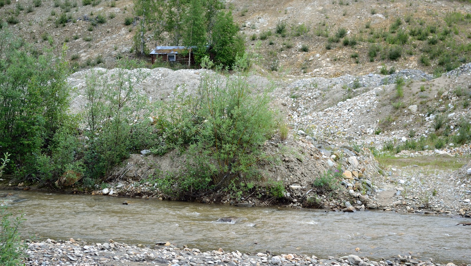
There is still evidence today of old mining claims along Bonanza Creek.
In saying that the area is still actively mined north of Bonanza Creek as evidence of the TV show Gold Rush. We watch the show all the time. Susan and I were getting into our truck and who drives by but Parker from Gold Rush. Sorry no pictures happened way to fast.
So what do you do when you have read all the history on the Klondike and seen Discovery Claim, well you try it for yourself at Claim 33. We didn’t strike it rich but let’s say we struck gold and had a great time.
After striking it rich we all thought we were pros at this gold mining business. Claim 6 is a free claim that anyone can pan for gold at any time with a few limitations. So with pans and shovel in hand away we go.
We didn’t find any gold but had a great time.
Before departing Dawson I had to find my cousin. After supper I was on a mission, and sure enough I found him. That made my trip to Dawson even that much better. It was just bad we couldn’t spend more time together. He was working, I was leaving.
Gold seekers heading to the Klondike in 1898 were required to pack and carry their goods over the Chilcoot Pass. The list of supplies required for each man included 400 pounds of flour, 100 pounds of beans, and 100 pounds of sugar. These are just a few of the items they had to carry. The average man took about 40 trips to haul his supplies to Bennett. That’s over icy trails, through blizzards and sub-zero conditions, not to mention the Chilcoot Pass Summit.
During a global depression and the associated widespread unemployment in the 1890’s thousands of men and a few hundred women joined the Klondike Gold Rush. Most seekers found no gold but the prospect of sudden riches was not all that mattered. The Klondike represented escape from the humdrum life and the adventure of a new frontier.
Not long after gold was discovered in the Klondike, dredges started showing up in the Yukon. One of two dozen dredges worked this area was Dredge No. 4 which rest on Claim No. 17 below Discovery on Bonanza Creek near the spot where it ceased operations in 1959. It was the largest wooden hull, bucket-line dredge in North America.
To get gold from the ground, the bucket line dug down to bedrock bringing gravel up to the hopper. Gold is heavy, so gravity sorted it from the waste as it passed through the trammel and sluice. The sluice worked like gold pans, trapping the gold in the riffles and coconut matting then sending the waste out the stacker.
Dredge No. 4 worked its way up the Klondike Valley into Hunker Creek. The ground at the mouth of Hunker Creek was so rich the dredge produced as much as 800 ounces of gold in a single day. Over 46 years, Dredge No. 4 recovered eight metric tons of gold.
All placer (loose) gold mining required two things: water and gravity. Inside the dredge, a large pipeline sprayed water into the trammel to wash the smaller and heavier gold bearing gravel through the holes into the sluice tables. More water washed over the sluice tables and washed away all but the heavier gold particles.
Before the Bonanza Creek discovery, the first major find of coarse gold flakes and nuggets came on Forty Mile River in 1886. Prospectors travelled up the Klondike River but they overlooked the rich pay streaks of the tributaries.
In July 1894, Robert Henderson started prospecting the tributaries of Indian Creek and in 1896 started mining on Gold Bottom Creek in the Klondike Drainage. Henderson met George Carmack at a fish camp and invited him to visit his workings at Gold Bottom. About 20 days later George Carmack, Skookum Jim, and Dawson Charlie travelled up Bonanza Creek to visit Henderson and found some gold flakes. The three men staked claims at the richest spot they found. George went to Forty Mile to record them. No one felt the need to tell Henderson and by the time he found out all the rich ground was staked. While Carmack was recording the claims, Skookum Jim was credited with sinking the first post on Bonanza Creek.
And this is where it all happened. The picture is of Skookum (far left), George Carmack (center), and Dawson Charlie (far right). There’s a great one kilometer trail that talks about the discovery of gold and how mining has evolved over the years. You can even site at the site where the first gold discovery was made.
| Bonanza Creek |
There is still evidence today of old mining claims along Bonanza Creek.
In saying that the area is still actively mined north of Bonanza Creek as evidence of the TV show Gold Rush. We watch the show all the time. Susan and I were getting into our truck and who drives by but Parker from Gold Rush. Sorry no pictures happened way to fast.
So what do you do when you have read all the history on the Klondike and seen Discovery Claim, well you try it for yourself at Claim 33. We didn’t strike it rich but let’s say we struck gold and had a great time.
After striking it rich we all thought we were pros at this gold mining business. Claim 6 is a free claim that anyone can pan for gold at any time with a few limitations. So with pans and shovel in hand away we go.
We didn’t find any gold but had a great time.
Before departing Dawson I had to find my cousin. After supper I was on a mission, and sure enough I found him. That made my trip to Dawson even that much better. It was just bad we couldn’t spend more time together. He was working, I was leaving.
Subscribe to:
Posts (Atom)