Our next stop on this wonderful adventure is Forillon National Park. It is one of Canada's 38 national parks covering 244 square kilometres. It is located at the upper point of the Gaspe Peninsula in Quebec. It is close to the biggest city on the peninsula, Gaspe. Forillon was the first national park in Quebec created in 1970. That came about with allot of controversy...more on that later.
Our site for 3 glorious nights. Brownie our oldest dog is still having some serious pain from his fall. We had to take him to an emergency vet clinic $$$$$ in Gaspe where we got pain meds for him, plus a couple of injections, and an anti-inflammatory. Lets hope it works.
There are 3 visitors centers at Forillon, the south, north, and entrance. The south visitors centre which is close to where we are has a pool, tennis court, restaurant, laundry, store, and so on. Pretty nice.
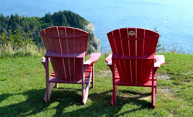
The first hike I went on is the La Chute Trail. It is a 1 km loop and considered moderate in difficulty. It's basically a dirt path that traverses through the forest but the reward is a beautiful cascading waterfall at the end. The difficulty is the 50 metre drop in elevation. What goes down must go back up. It's also home to a red chairs.
There are very few old historic buildings in Forillon NP left over from the once thriving communities that called this home. The Hyman House & General Store is a 2 storey building where William Hyman lived and sold his merchandise. It was built in 1864. Hyman was instrumental in the development of the cod industry along the Gulf of St Lawrence and a driving forces behind the Gaspe economy.
While most families during the mid 19th century turned to the sea to make a living many families in the Grande-Grave community did a little mountainside farming. The Anse-Blanchette House bears witness to the fisherman-farmer lifestyle.
Now for the controversial part of Forillon National Park. At one time the area was home to 220 families spread out over seven communities. This is long gone today. Why? These families where forced to leave against their will to make room for the national park. It all started in the 1960's when the Canadian Gov't was looking to expand it's national park system into Quebec. The Canadian and Quebec gov't in June 1970 reached an agreement to expropriate the land in Grande-Grave and several other communities. People were forced to leave their homes, businesses, income, and heritage. Very little compensation was given to these families for their property. Shortly after the expropriation the gov't burned down most of the buildings only leaving 4 houses, some barns and other structures...a very sad time in Canadian history.
The north entrance discovery centre houses a gift shop and information centre. A short distance down the road is the Cap-des-Rosiers lighthouse built in 1958. It is the tallest lighthouse in Canada at 34.1 metre or 112 feet. Cap-des-Rosiers is situated at the mouth of the St. Lawrence where it meets the Gulf of St Lawrence.
My last hike before we have to leave Forillon National Park is to "Land's End". I decided to bike instead of hike...little did I know. Anyway the L’Anse-aux-Amérindiens bike ride starts in the parking lot and is 6.4 kms long with an elevation gain of 95 metres...yes over 300 feet. It consists of a gravel road that has washed away due to rain.
This is also the start or Point 0 of the International Appalachian Trail (IAT). The 650 km trail connects Forillon NP to Matapedia in Quebec.
Perched on top of the hill is the Cape Gaspe lighthouse. The original was built in 1873 burning down in 1892. After climbing to the top I was able to admire the third lighthouse which was built in 1950 from concrete. I also got to have my red chair moment while enjoying the view.
Going down is usually easier than going up but in this case my bike is not great on gravel so I was full on back break going down with very little front. It was a challenge. But I do love a challenge. You can see the elevation change. In the distance is the sea and I am parked at sea level.


No comments:
Post a Comment