Tuesday, July 31, 2018

Day 64 & 65 - Haines Junction, YT

After a fun night in Tok it was time to be on the road again. Our next destination is Haines Junction, Yukon. Yes, we will be back in Canada soon.

Just after we dieseled up we started noticing the smell of smoke in the air. I found out later it was a wildfire near Tok. The Taixtsalda Hill Fire southeast of Tok has grown significantly since it started. The fire is now estimated at 18,406 acres. The fire, which started July 23rd, is burning in a remote area approximately 14 miles southwest of the village of Northway and 38 miles southeast of Tok. It is approximately 20 miles west of the Alaska Highway. It is being investigated but human error is likely the cause. At one point the smoke got pretty thick. Anyone with a breathing issue would be in trouble.
We made a quick stop at the international border rest area for a photo op. The 141st meridian longitude marks the boundary between the Yukon and Alaska. This boundary extends from the Arctic Coast to Mount St Elais, a distance of 2,475 km. The border between Canada and the United States is the longest undefended boundary in the world.

The line that forms the border between the Yukon and Alaska was first described in an 1825 treaty between England and Russia. The two nations divided the northwest giving Britain the rights for inland fur and Russia rights to the Bering Sea. In 1867 the U.S. purchased Alaska (I mentioned this in another blog). When gold was discovered in the Klondike in 1896, a dispute erupted regarding the southeast boundary, with both Canada and the U.S. claiming the seaport at the head of Lynn Canal. In 1903 the arbitrators ruled that the canal was part of Alaska and not Canada.
Behind the middle spruce tree is a 20 foot or 6 meter swath of land that was cut by surveyors in 1904 to 1920 which marks the Alaska-Canada border. Portions of the swath is cleared periodically by the International Boundary Commission.
We reached Canada Customs and the young customs officers looks like he just came from a gold rush town. He was really nice, asked alot of questions I'd never been asked before. He also wanted to see the dogs vaccination papers. Again, something we had never been asked. Most of the time they don't know we have dogs in the back seat.
We made a quick stop or we thought it was going to be quick at Pickhandle Lake Rest Area. It was so beautiful and peaceful we stayed longer, just to admire the view and watch the ducks come and go. This lake is one of western North America’s most important bird migration corridors leading from South America, the Gulf of Mexico, the US Midwest, the west coast of the US and Canada into central Yukon and Alaska. This lake is a primary nesting area for trumpeter swan. Today we saw none. 
Between 300 and 400 years ago, Kaskawulsh Glacier advanced across the Slims River closing the drainage outlet of Klaune Lake. The water levels rose more than 10 meters or 30 feet reversing the lake's drainage pattern. Today, that drainage pattern has been permanently altered resulting in a beautiful blue lake.
Haines Junction is best known as the access point to Kluane National Park and Reserve, a beautiful wilderness park, with glaciers, mountains, and wildlife. Kluane National Park and Reserve, together with Tatshenshini-Alsek Provincial Park in British Columbia, Wrangell-St. Elias National Park and Glacier Bay National Parks in Alaska, form the largest internationally protected area on earth. In 1980, Kluane National Park and Reserve was designated a UNESCO World Heritage Site. The park encompasses a portion of the St. Elias Mountains, including Mount Logan, Canada's highest peak.


The village itself was established in 1942, during construction of the Alaska Highway. The area population of Haines Junction in approximately 850 people.
The view from our back window
The new Champagne and Aishihik First Nations' Da Ku Cultural Center is also the home of Parks Canada and Yukon Territorial Visitor Center. We had to explore. An elder died so the Da Ku Center part was closed. We watched a 25 minute film on the Kluane National Park. It was one of the best we have seen so far.
Our Lady of the Way Catholic Mission is quite a local attraction. It was built in 1954 by the first Catholic priest to preach in the area. Because resources were scarce the priest converted an old Quonset hut (lightweight prefabricated structure of corrugated galvanized steel) used by the American Army during construction of the Alaska Highway.
Another unique and quaint church is the St. Christopher's Anglican Church which sits in the heart of Haines Junction. This church was constructed in  early 1990 by local volunteers and is used for Sunday services even today.
The most photographed spot in all Haines Junction is the Village Monument. The 24 foot high sculpture which locals have nicknamed "The Muffin" or "Animal Cupcake" is located at the junction of the Haines and Alaska highways. The sculpture depicts almost life size area wildlife on a snow capped mountain.

Sunday, July 29, 2018

Day 63 - Tok, AK

We left Valdez around the same time as we normally start to travel, 8:30. It was overcast but not raining. It almost looked like the sun wanted to come out. We drove through Keystone Canyon again this time we could see the falls a lot better. The truck lane begins northbound for those who will be going slower like me, starting that long steep climb up Thompson Pass. Thank goodness it’s still cool out. Side note! This was the most difficult part of the pipeline construction, requiring heavy blasting of solid rock for several miles. At this point the pipeline runs entirely underground beside the highway. Continuing on up the pass in the slow lane we make it. We make a quick stop to let Precious cool down and then we are off again.  From sea level or 0 feet to 2,678 feet in 7.5 miles, that’s a climb. We make the descent on the back side of the pass only to see Worthington Glacier coming into view.
The mountains begin to disappear as we get further down the road. We make a stop at the Wrangell-St Elias National Park Visitors Center to look around and also have lunch.
Widely used today on the Yukon and Copper Rivers, the fishwheel was introduced into Alaska near the turn of the 20th century. The fishwheel is powered by the force of the water. The current pushes the paddles making the baskets revolve around a central axle. The baskets scoop up the salmon as they swim upstream and empties them into the fish box. The box collects the fish and holds them until someone comes to empty it.
Mount Drum which is part of the Wrangell Mountains dominates the skyline to the east. The elevation is 12,010 feet.
When we were driving earlier today, we had decided to stay in a different campground than the one we stayed in last time. We chose Sourdough Campground which is just south of Tok by 1 mile right on the Richardson Hwy. We pull in get all set up and I take the dogs for a walk. As I’m walking I’m starting to see people that I’ve seen earlier in our trip. I guess they are on their way back. The campground maintains a rustic feel with memorabilia dating back to the gold-rush days. There’s a community campfire where everyone is welcome, bring marshmallows to roast etc.
 When I checked in I was told the pancake toss was at 7:30 in the pavilion. The what! Anyway Susan and I had to check it out. Sure enough you stood behind a bench and tried to toss a pancake into the bucket 7 feet away. You got two tries, the first doesn’t count. Susan got up and she missed both times. I was next. The first one I missed but I aced the second. The prize is a mini pancake that you redeem the next morning for a monster free breakfast. What a fun time.
All the Winners

Some of the Losers
My mini pancake prize

Saturday, July 28, 2018

Day 61 & 62 - Valdez, AK

The original town of Valdez existed at this site from 1898 to 1967. This was Mile "0" of Alaska's first highway, the Richardson Highway. The Richardson was originally built by the U.S. Army soldiers of Fort Liscum in 1899. It became a major transportation route for supplies and people travelling between coastal Valdez and northern communities. The population of Valdez in the early 1960's was between 600-700 people. Old Town Valdez thrived because of its shipping and transportation industries. Valdez may have disappeared like many gold-rush era boomtowns if the highway had not been built.

In the 1950's and 1960's this was a very busy town. Freshly loaded with crates and containers from the steamships docked at the waterfront, trucks were bound for military bases, communities, roadside lodges, and numerous other stops.

In 1964 the largest earthquake in North America struck Alaska devastating Valdez. Thirty two people were standing on the dock either helping or watching the unloading of the SS Chena.  All 32 died as the dock collapsed into the ocean. No one was ever found. Afterwards the U.S. Army Corp of Engineers condemned the town site. All the people living in the town were given two years to pick up the pieces and move four miles down the road to a newly created town. By 1967 new Valdez became home for the residence. 
Old Valdez today, or whats left of it. I had a guided tour around the old town. It had such an eerie feeling the fog didn't help.

The Village Morgue Bar was used in the 1920's as the title indicates the village morgue. Bodies would be stored during the winter in the building until graves could be dug in the spring. It then became a bar with a bass, piano, and saxophone band.
Before the earthquake - Village Morgue Bar

After - Village Morgue Bar Site
Valdez City Dock Site
Abandoned Fork Lift from Earthquake Days

The Solomon Gulch Hatchery was completed in February 1983 to ensure sufficient numbers of salmon return each year. The facility is licensed to incubate, rear, and release 230 million pink salmon and 2 million coho.

A fish weir is a structure that is designed to catch or restrict fish movement upstream. Fish below the weir are adult pink and coho returning to the hatchery to complete their life cycle by spawning and dying. These fish were spawned, hatched, and released from this hatchery.

The purpose of the weir is to direct the fish into the hatchery system to be artificially spawned. The fish are restricted from swimming further up Solomon Creek as the spawning and rearing area is not large enough to support the high numbers of fish the hatchery produces. 

The fish ladder has 29 steps each slightly higher than the last, with slots that allow the fish to pass through. Upon making it to the outdoor raceways, they gather with others to make the final push into the spawning building.
Fish Ladder
Outdoor Raceways
Fish waiting to climb the ladder
Easy meal for sea lions
Thousands waiting to spawn
Another sea lion scouting an easy meal
Solomon Gulch Falls
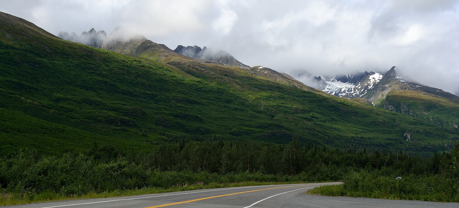
There is a plethora of things to see and do in Valdez. Simply, the beauty can be breathtaking.
Tankers awaiting their valuable cargo
Braided river no bears here
Competitors getting ready for the carving contest
Paddlers coming from Valdez Glacier
All the icebergs are from the glacier
The water was really, really, cold
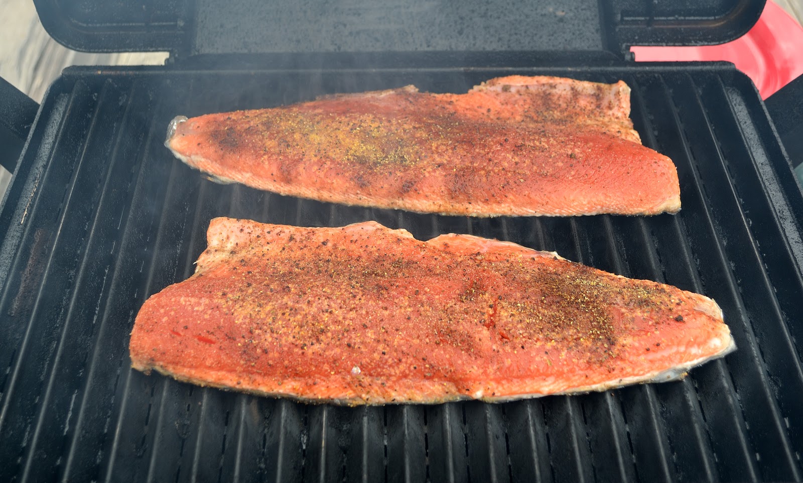
After seeing all that salmon I decided that we needed a feast of red or sockeye salmon for supper. I did it on the grill, it turned out amazingly good. This was given to us earlier on in our trip.

Thursday, July 26, 2018

Day 60 - Valdez, AK

After saying our good-byes, we left Glennallen around 8:30 under rainy skies. We left the Glenn Hwy and turned onto the Richardson Hwy which will lead us right into Valdez, our next destination.

In 1897 gold seekers flocked to Valdez to follow the "All American Route" which took them over the Valdez Glacier into the interior of Alaska. A tent city sprang up at the head of the bay, Valdez was created. In 1907, copper discoveries north of Valdez brought conflict and more development in Valdez. A proposed railroad from Valdez to the rich Kennecott copper mines near McCarthy began a bitter rivalry. A shootout ensued and a half-completed tunnel at mile marker 15 on the highway is all that remains. In 1919 the original gold rush trail was modified into a sled and wagon road. It was routed over Thompson Pass rather than Valdez Glacier. Colonel Wilds Richardson further developed the trail by making the first automobile road. This road renamed the Richardson Highway became Alaska's first highway making Valdez a coastal port for the interior.

Until 1964, Valdez was located 4 miles east of its present location. Much of the original town was destroyed by the Good Friday earthquake (more on that later). The Trans-Alaska pipeline was built between 1975-1977 and carried oil to the nearest ice-free port, Valdez. In 1989, the largest oil spill in North American history, at the time occurred 25 miles from Valdez . The oil tanker Exxon Valdez hit Bligh Reef spilling 11 million gallons of crude oil. Today, much of Valdez's economy depends on the oil, fishing, and tourism industries.

As we got further down the Richardson Hwy the sun is actually trying to poke it's face out. We can now see the beauty that everyone talks about as we wind our way around the mountains.
Worthington Glacier is one of the most accessible glaciers in Alaska. It is located at mile marker 29 on the Richardson Highway. The glacier head is on top of Girls Mountain an elevation of 6,134 feet. By the low cloud cover we are starting to climb just a little.

Worthington Glacier
As we climb Thompson Pass the cloud cover descended upon us. It's like being in a totally different world. The temperature dropped by 20 degrees F. Valdez receives more than 27 feet of snowfall on average each year. Thompson Pass receives 50 to 75 feet of snowfall on average each winter. They receive so much snow that snow poles are placed along the highway marking the edge of the road for plows. We reached the Thompson Pass Summit elevation is 2,678 feet. Can't see anything.

What goes up must come down and that is precisely what we are doing. It's a 7.5 mile long steep descent into Keystone Canyon.  Valdez has some of the most breathtaking waterfalls in the world. Growing up near Niagara Falls I couldn't imagine anything being as great. With huge snow falls each winter and then the snow melts in the spring and summer, Valdez becomes The Land of Waterfalls.

We drove into Keystone Canyon which is located between miles 14 and 17 and there before us was one of many water falls...Bridal Veil Falls cascading over the rock into Lowe River.

Bridal Veil Falls
Keystone Canyon and Lowe River
Horsetail Falls


We arrive in the town of Valdez under rainy overcast skies but that is not going to stop me from walking around the town to view the sites.

This beautiful eagle was sitting in tthe tree beside our campsite. What a nice welcoming committee.

The downtown area is not all that big. There's a nice boardwalk beside the small boat marina. I've come to realize real fast, if you don't fish there's not much sense of living in Valdez. Everyone has a boat and everyone fishes.

This Hoary Marmot was just hanging out

Oops
Lots of domestic rabbits


We had a great time exploring...lots more to do tomorrow. So far Valdez is a great place to hang out.