Wednesday, July 25, 2018

Day 59 - Glennallen, AK

Today is all about the drive from one town to the next. We have not done that in awhile. It's also a bitter sweet trip. Sweet because it's getting us to another new place to explore. But on the other hand it's sad because we say goodbye to our friends and travelling companions as they make their own way back home.

We left Palmer this morning around 8:45 with our destination being Glennallen approximately 155 miles away. The trip is going to be slow since we climb to 3100 feet then drop back down to around 1200 feet as the road winds around the mountains and rivers.

Glennallen is known for its outstanding scenery. Its located in the Copper River Basin at the junction of the Glenn and Richardson Highways. It is also the gateway to Wrangell St. Elias National Park the largest National Park in the U.S.

In 1898 the area saw an influx of gold seekers heading for the Klondike. This route was chosen in an effort to avoid tariffs assessed by the Canadian Government. Their effort failed as they had to enter Canada to get to Dawson.
Fireweed just coming into bloom


Stopping for a scenery break
The Matanuska Glacier is the largest glacier in Alaska that can be reached by vehicle. It originated from within the Chugach Mountain Range. It's approximately 26 miles long and 4 miles wide at its terminus. About 10,000 years ago the Matanuska Glacier began it's retreat to it's present day location. It has not change much in mass for almost two decades. It is classified as a valley glacier meaning a body of solid ice flows like a river under its own weight through an existing valley. Matanuska Glacier is considered a weather hole, meaning cold air from the glacier forces warm air upward towards the mountain peaks. This results in sunny skies and more favorable weather than the surrounding areas.
Matanuska Glacier
Note the tire skid marks on the road
Copper River Valley Mountains

Wrangell Mountains in the background 
We arrived at Caribou Lodge and RV Park got checked in and set up. Our fridge totally went down in Palmer so I had to go out and buy a Yeti cooler. They work fantastic but I know we will lose most of our meat. So we decided to make hamburgers for all six of us. We had great fun our last night together.

Tuesday, July 24, 2018

Day 57 & 58 - Palmer, AK

During the great depression of the 1920's and 1930's, the U.S. federal govt instituted a program to relocate destitute Midwest farm families to the Alaska Matanuska Valley. Some 203 families from Michigan, Wisconsin, and Minnesota were selected to participate in this program to establish an agriculture-based community. It was called the "Matanuska Colony Project". Each family was given 40 acres of land, a new house, barn, animals, and equipment to support a family farm. A central community center including a store, school, railroad depot, churches, and support facilities were built. All this became the foundation for the city of Palmer.

Today, Palmer is an agricultural community. Many descendants of these "colonists" continue to live and farm this very area. The Matanuska Valley was carved by glaciers thousands of years ago. The fine, fertile silt left behind by the receding glaciers along with the long daylight hours makes the area perfect for growing world record vegetables. We got to see the fields upon fields of lush hay and green vegetables. However, our focus was finding some four legged creatures.

I know we have seen musk oxen before but none of us could pass up the chance to see them again. This time we can get a little closer. How this musk ox farm came to be! In 1954, John Teal captured three musk ox calves in the Canadian Northwest Territories. He transported them to his family farm in Vermont where he devoted the next 10 years proving they could be tamed, raised, and bred in captivity. Also their qiviut could be collected in useful quantities.

In 1965, Teal established the first large scale musk ox farm in Fairbanks (I talked about this in an earlier blog). What I didn't say earlier was in 1976 Teal move the entire herd to a 640 acre property in Unalakleet, Alaska.

Following Teal's death in 1982 the Musk Ox Development Corporation assumed responsibility for the health and welfare of the herd. Relocating the herd was the first priority. The entire herd was brought to the Palmer region because of the availability of suitable property. And these are the descendants of that original herd.  

Beautiful farm with mountains all around
Curly, Larry, and Petunia

I found this tour so much better than the one in Fairbanks. You could get allot closer to the musk ox. Each musk ox is human imprinted from birth. The focus of this farm is totally different than the one in Fairbanks.

The second place we visited was The Reindeer Farm in the town of The Butte. The farm is set on 200 acres of land which has been in the Williams family for three generations. It was part of the Matanuska Colony Project that I talked about earlier. There passion for animals took them away from crops to raising reindeers - 120 of them.

After a quick introduction to the reindeer and a few do's and don'ts we were allowed to go into the coral and feed them. It was so much fun.
Baby Rocky Mountain Elk

Sunday, July 22, 2018

Day 55 & 56 - Seward, AK

For the next couple of days we spent time in the downtown area. Resurrection Bay which was carved out by millions of years of glacier activity, is now a deep fjord that extends nearly 35 miles north and south on the southeastern coast of the Kenai Peninsula.
As we walked around we saw some beautiful houses with breath taking views of Resurrection Bay and Mount Marathon. On the 4th of July each year runner race up this mountain then hurtle themselves down the rocky slopes at high speeds only to reach the bottom muddy, bruised, bleeding, and exhausted. Behind this house is Mt Marathon.
Seward might be at the end of the highway system but its not the end of the road. As we drove further south we came across Lowell Creek Waterfalls. When the original townsite of Seward was established in 1903, Lowell Creek ran down beside Jefferson Street. From the beginning severe flash floods would occur one to three times per year. During these times large quantities of debris, in varying sizes from gravel to large boulders would be carried down Jefferson Street. The Flood Control Project was completed in 1937. The project consisted of three parts: The Diversion Dam; The Tunnel; and The Outlet. This waterfall is that outlet which drains into the Bay.
Continuing further down the very narrow road, I found myself hugging the base of a mountain on one side and on the other is the Bay. Its all worth it because we arrived at Lowell Point, a beautiful recreation area.
A great house at Lowell Point overlooking Resurrection Bay
Another view of Resurrection Bay and the mountains
The Iditarod Trail began as a mail and supply route from the coastal towns of Seward and Knik to the interior mining camps at Flat, Ophir, Ruby and beyond to the west coast communities of Unalakleet, Elim, Golovin, White Mountain and Nome.  In the winter of 1925, a deadly outbreak of diphtheria threatened Nome's residents. Winter ice closed the port city from the outside world. Serum from Anchorage was rushed by train to Nenana and then picked up by sled dog relay. Alaska's best mushers carried the serum 674 miles to Nome in less than 5 1/2 days. The Iditarod Trail is now a National Historic Trail, and is called the “Last Great Race on Earth.”  Each year, an extremely competitive dogsled race takes place of more than 1150 miles from Anchorage to Nome. The route has changed over the years due to lack of snow, the distances have also changed.
Our last experience in Seward is the Alaska Sealife Center which overlooks Resurrection Bay. Opened in 1998 the $56 million 115,000 square foot facility was built as part of the settlement of 1989's Exxon Valdez oil spill.  The Center operates as a private, non-profit research institution and public aquarium. It's also Alaska's only permanent marine mammal rehab unit. They rescue stranded and injured seals, sea lions, sea otters, and sea birds. Seward was a major rehab site during the oil spill.
Tufted Puffin
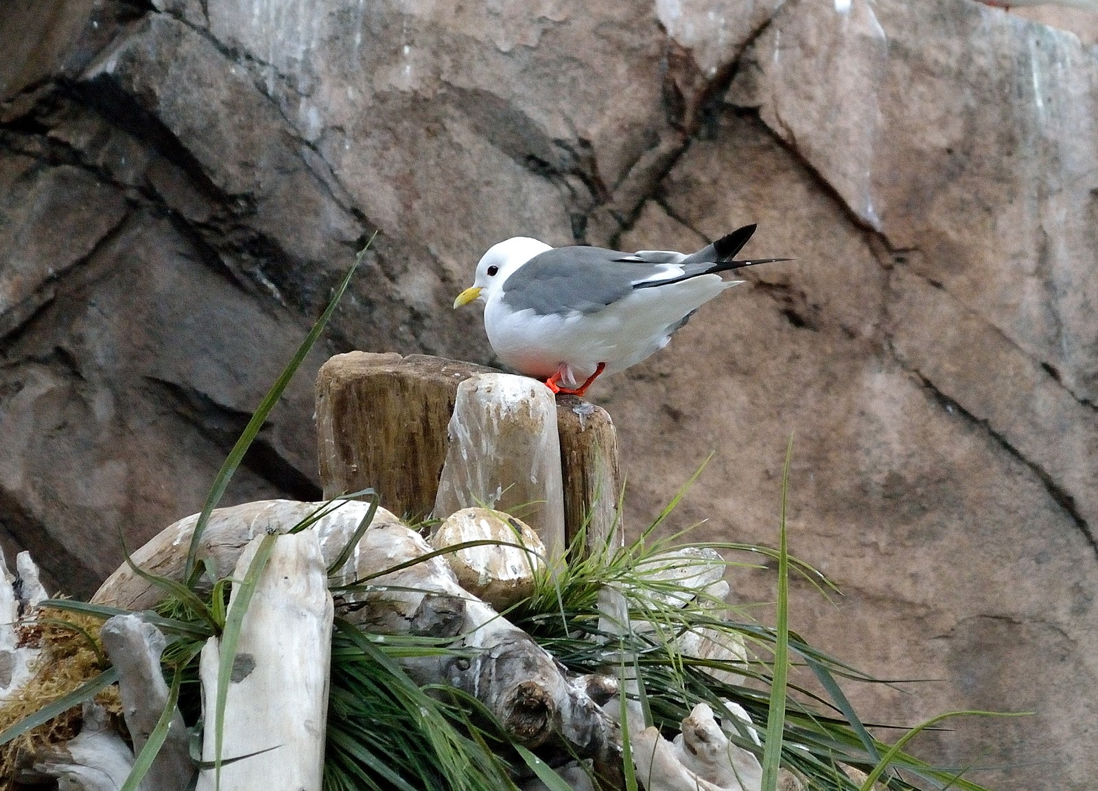
Red-legged Kittiwake
Horned Puffin

Friday, July 20, 2018

Day 54 - Exit Glacier, Seward, AK

After 3 wonderful days in Homer it was time to move on to our next destination, Seward (pronounced Soo-word) Alaska. We barely got down the road when I spotted someone pulling off the road and stopping. That always means some sort of wildlife is present. And sure enough there was mama moose and her two babies. It's going to be a great day.
Seward is situated at the head of Resurrection Bay on the Kenai Peninsula. It is surrounded by snow-capped mountains which are blanketed with lush green vegetation, trees and wild flowers. It has the only deep-water, ice-free port with rail, highway and air transportation in Alaska. 

In 1792, Russian explorer Alexander Baranof arrived by boat and is responsible for naming the port Resurrection Bay.
Seward was founded in 1903 and named after William Seward, who was instrumental in the purchase of Alaska from Russia in 1867. Seward had been a member of Lincoln's cabinet. After Lincoln's death, and the Civil War ended, the U.S. finished the transaction for pennies on the acre.

We arrived in Seward in really good time and it was a beautiful afternoon. I wanted to take advantage of the day so away we go to Exit Glacier which is not far, maybe 10 miles one-way.
Kenai Fjords National Park was created in the 1980's to protect the Harding Icefield and the nearly 40 glaciers that flow out of it. Many of the glaciers reach the ocean in fjords that can only be accessed via the water. Exit Glacier is the easiest glacier of the group to access and the only part of the Kenai Fjords NP accessible by road. The trail to the glacier outlook is just over 1 mile one-way. It starts flat then you start to climb. It's not all that difficult. There is a more strenuous climb to the icefields which is 8 miles long. You definitely need bear spray on the trail.
Exit Glacier Nature Center

Exit Glacier from the road
At the height of the last ice age, about 23,000 years ago Exit Glacier filled the valley. Today, this once massive glacier is retreating rapidly. In the last ten years it has melted back almost 1,000 feet.
Looking behind me at the mountains
The gravel outwash plain from glacier melt
The trail
Lush green mountains
Picture of Exit Glacier in 2004
Photo Courtesy of  the National Parks
Picture taken in 2010 - Exit Glacier receding
Exit Glacier Up Close
Exit Creek and Flood Plain
Another wonderful day filled with wildlife and adventure. Time for something to eat. All this walking has made me very hungry. It's fresh halibut done on the grill tonight. Yummy!

Thursday, July 19, 2018

Day 53 - Homer & Nikolaevsk

We decided to drive North Fork Rd out of Anchor Point to visit the Old Russian Village, Nikolaevsk. There are four Russian “Old Believer” communities that have developed on the southern Kenai Peninsula. Old Believers or followers of the Russian Orthodox Old-Rite Church began leaving Russia in the early 1900s in order to practice their religion without persecution. Their journey took them into China, then South America, the Pacific Northwest, and finally five families came to the Kenai Peninsula.

The first Old Believer community on the Kenai was the one we are going to visit first, Nikolaesk. It was established in 1968 and presently has about 350 residents. Men and boys wear colourful embroidered shirts with hand woven belts while women and girls wear ankle-length dresses. Or we thought! There are also three other Old Believer communities near Homer, Voznesenka, Razdolna, and Kachemak Selo.

As we drove toward the Russian Village we saw some really strange looking houses. But we noticed that throughout all of Alaska. Some so small a dog house looked bigger. Then there was this one.
We got to the Russian Village not really sure what to expect. The houses look pretty much like the rest of Alaska, maybe a little more run down and dilapidated. I had done a little research on line and found Nina’s place.

We went in and right away I could tell it was all about the money. To take a picture was $20 of her in costume. To take a picture inside was $20. She wanted you to have tea and bread with her that was $20. So you get my point. We left like we came with nothing. 

Then we went back to the church took a couple of pictures and left. I guess we were a little disappointed. The people we did see in the village did not wear the sash or cross and men did not have the long beards. With that we decided not to go to the other villages.
Instead we went on a scenic drive to get another amazing view of Homer Spit. Then we drove back into Homer for one last look around before we have to leave tomorrow. The Seafarer’s Memorial is dedicated to all those that have lost their lives to the sea.

Our final stop was at the boat graveyard. Several old boats that were once worthy vessels of the sea now sit up on stilts collecting dirt and sea salt.